Floor map, scale and zoomer
Set your floor maps for your deployment planning
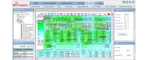
You can load a floor map within the system pop-up. The floor map can be any image files of commonly used graphic file format located on your local computer.
Once the floor map is loaded, you need to set the scale of the floor map, which is the distance in the real world between two points on the floor map. You can set the display scale of the floor plan by directly changing the number on the ruler. Scale can be set in feet or meters.
![]()
![]()
Alternatively, click the square ruler icon on the left end of the ruler, a pop-up will prompt you to click on any two points on the floor plan, point A and point B respectively. Click on the floor map for two points A and B, then right-click for a pop-up for entering the scale number of the distance between point A and B.


To magnify or shrink the view of the floor plan, you can zoom in and out by utilizing the Zoom In and Zoom Out buttons on the Button tool-bar. You can also use the percentage box to increase or decrease the size of the floor plan. Note that zooming in and out only changes the view of the floor plan and will change the scale.
![]()


Leave a Reply
Want to join the discussion?Feel free to contribute!